
Land Surveying for Flood Risk Assessment and Management
 Floods are one of the most devastating natural disasters that can occur, causing significant damage to properties, infrastructure, and even loss of life. With climate change leading to more extreme weather events, the risk of flooding is increasing. As a result, effective flood risk assessment and management have become essential for communities and governments worldwide. Land surveying plays a crucial role in this process, providing accurate data and information necessary for understanding the flood risk and developing appropriate mitigation strategies. In this blog post, we will explore the importance of land surveying in flood risk assessment and management, along with the various techniques and technologies employed in this field.
Understanding Flood Risk through Topographic Surveys
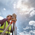
Topographic surveys serve as a foundational element in flood risk assessment. By defining the elevation characteristics and features of an area, topographic surveys provide essential data for determining floodplain boundaries, identifying potential floodways, and understanding the hydraulic behavior of water bodies during flooding events. These surveys are typically conducted using advanced surveying instruments such as total stations and laser scanners, enabling accurate mapping of ground topography. The data collected helps engineers and planners develop flood models and simulations, allowing for accurate predictions of flood extent and intensity.
Precise Elevation Measurements with GPS/GNSS
Global Positioning System (GPS) and Global Navigation Satellite System (GNSS) technologies have revolutionized land surveying by providing precise and efficient positioning capabilities. These systems allow surveyors to collect elevation data with high accuracy, enabling them to accurately represent flood-prone areas on maps and models. Utilizing GPS/GNSS technology also simplifies the process of tracking the movement and velocity of floodwaters during an event, aiding in flood forecasting and emergency response efforts.
LiDAR: Revolutionizing Flood Risk Mapping
Light Detection and Ranging (LiDAR) technology has rapidly advanced and become a game-changer in flood risk assessment and management. By emitting laser beams and measuring the time it takes for them to bounce back after hitting surrounding objects, LiDAR systems can create high-resolution elevation maps, providing detailed information about the topography and characteristics of an area. When used in tandem with aerial surveys, LiDAR enables the generation of accurate digital elevation models (DEMs) and flood extent maps, helping identify areas prone to flooding and supporting effective land use planning.
Analyzing Historical Records and Hydrological Surveys
In addition to capturing current topographic data, land surveying also involves the analysis of historical flood records and conducting hydrological surveys. Historical flood records provide invaluable insights into past flood events, their magnitudes, and associated damages. By combining this historical data with current topographic surveys, land surveyors can identify flood-prone areas and track changes in flood patterns over time. Hydrological surveys aid in gathering information about local hydrological conditions, such as rainfall patterns, river flow rates, and water retention characteristics, further enhancing the accuracy and reliability of flood risk assessments.
Real-Time Monitoring with Remote Sensing Techniques
Recent advancements in remote sensing techniques have opened up new possibilities for real-time flood monitoring and management. Satellite imagery, coupled with radar and infrared sensors, enables the continuous monitoring of water levels, flood extent, and changes in river courses. This data, combined with ground-based monitoring stations and IoT devices, provides emergency responders and decision-makers with up-to-date information, supporting timely evacuation plans, flood defense operations, and effective resource allocation.
Summary
Land surveying plays a vital role in flood risk assessment and management by providing critical data and information necessary for understanding flood dynamics and developing effective mitigation strategies. Topographic surveys, precise elevation measurements with GPS/GNSS, LiDAR technology, historical analysis, hydrological surveys, and real-time monitoring through remote sensing techniques are all essential components of this process. By harnessing the power of land surveying, communities and governments can make informed decisions, reduce flood hazards, and protect lives and properties from the devastating impacts of floods.
Need Site Engineers & Land Surveyors in Seguin, TX?
Bettersworth & Associates, Inc. is an experienced team of resourceful and award-winning land planners. Established in 1953 in Seguin, Texas, we have gained recognition in creating better places in which to live, learn, work and play. Our goal is to improve the value of our clients’ land resources in a way that advances their missions and improves their communities. We are proud of the long-term relationships we have developed with our clients through creative and responsive advocacy. These relationships have helped us earn a reputation for getting noteworthy projects built in each industry we serve. Call us today!
Categorised in: Land Surveying